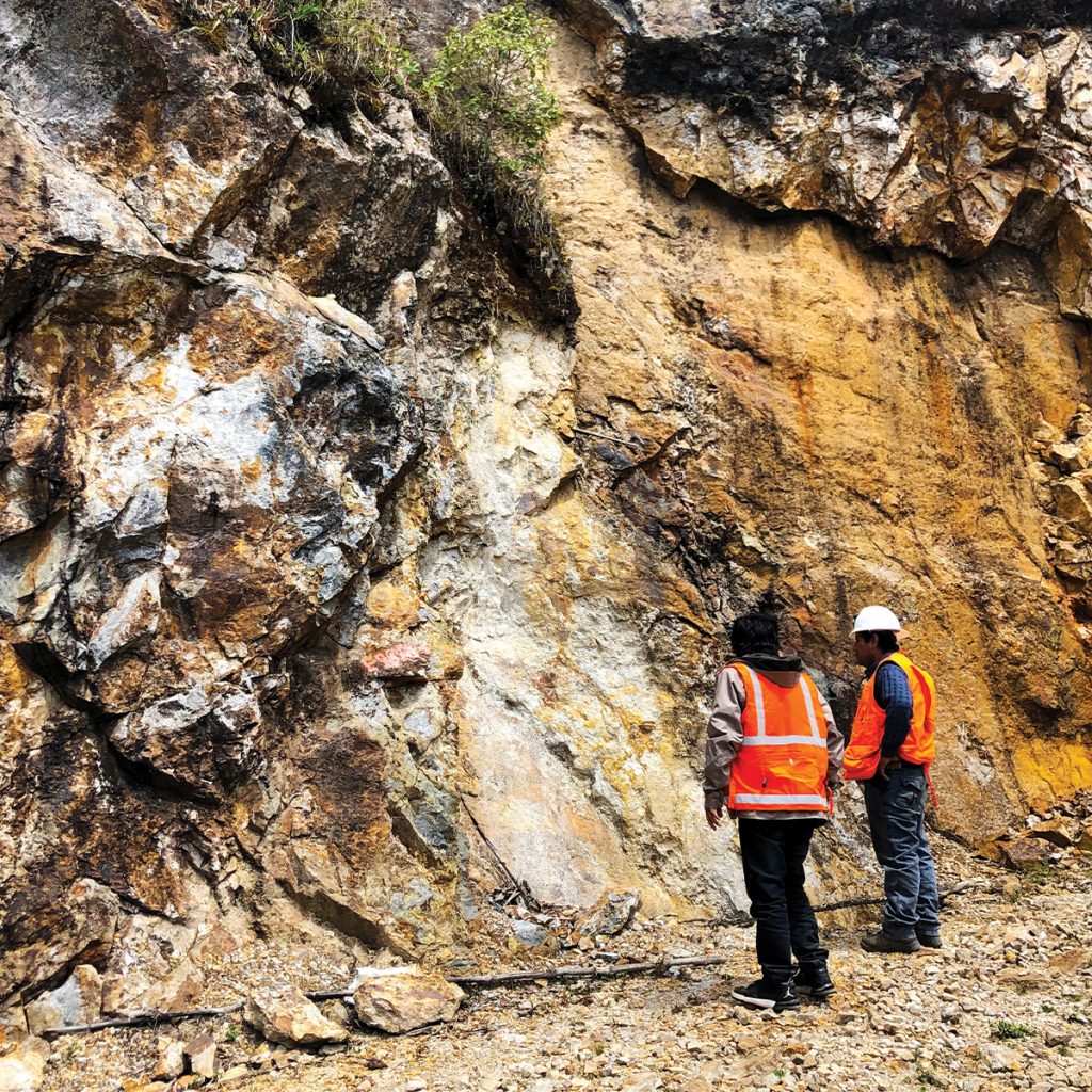
Quartzite, arenite and shale of the Chimú Formation.
Arenite, quartzite and carbonaceous shale with syngenetic pyrite in the underlying Chicama Formation.
The sedimentary sequence has been extensively folded, thrusted and dissected by major faults. The structure is dominated by an anticline some 3 kilometres (km) long and 2 km wide. Intruding the sedimentary rocks are numerous dacitic dykes, stocks and sills that are typically altered to a phyllic hydrothermal assemblage (quartz-sericite-pyrite). Minor granodiorite is present some deep drill holes.
Precious metal mineralization at Igor consists of a series of veins, breccias and mantos principally with a north to south orientation, although secondary north-east to south-west and north-west to south-east trends are also important. Gold and silver are the most important metals. Geochemically, arsenic and antimony commonly accompany precious metal mineralization. Weak localized base metal (lead and zinc) mineralization is also present. Copper grades are generally low, but frequently increase with depth, especially in the Portachuelos area. Oxidation, especially along structures, is pervasive and commonly extends to depths of several hundred metres. Gold and silver mineralization appears to bel ow to Intermediate sulphidation epithermal in character and there are indications of a deep porphyry copper gold system underlying the Igor District.
IGOR contains a district scale hydrothermal system with four principal gold and silver mineralized areas of deposits:
Callanquitas: Gold and silver mineralization consists of a series of north-south striking, structures over a zone some 900 metres long and 200 to 300 metres wide. Mineralization is open to the north, south and at depth. Mineralization is characterized by thick zones of tectonic and hydrothermal breccia that host gold and silver mineralization within which are discrete, continuous zones with very high grades, e.g. diamond drill hole CA-17-86, 3.3m grading 27.72 gpt Au and 242 gpt Ag (30.97 gpt Au Eq). The December, 2012 NI 43-101 Technical Report describes this area in detail.
Domo: A zone of bedding-parallel mantos and perpendicular veins along the crest of the southeast end of the Igor Anticline. Precious metal mineralization is controlled by a series of northeast-southwest trending faults.
Tesoros: A system of veins, breccias and mantos along a major north-northeast striking fault that has localized the emplacement of dacitic porphyries and pebble dykes. Historic drill hole 9d cut 75.2m grading 3.1 gpt Au and 109 gpt Ag (4.55 gpt Au Eq), emphasizing the potential for good grade, potentially bulk minable, gold and silver mineralization in the Tesoros area.
Portachuelos: The Portachuelos discovery is located over 800 metres south of the existing Callanquitas resource and represents a new area of shallow, lower grade gold and silver mineralization hosted by tectonic and hydrothermal breccia. The Portachuelos mineralized zone has a strike length of approximately 650 metres, a true thickness of up to 40 metres and has been drilled to a depth of 130 metres. The gold and silver mineralization at Portachuelos is open in all directions, vertically and laterally. Diamond drill hole CA-18-94 intercepted 40.2 metres grading 1.18 gpt Au, 115.4 gpt Ag, (2.72 gpt Au Eq) at a vertical depth of only 25 metres, highlights the resource potential of this area.